Association Boundaries
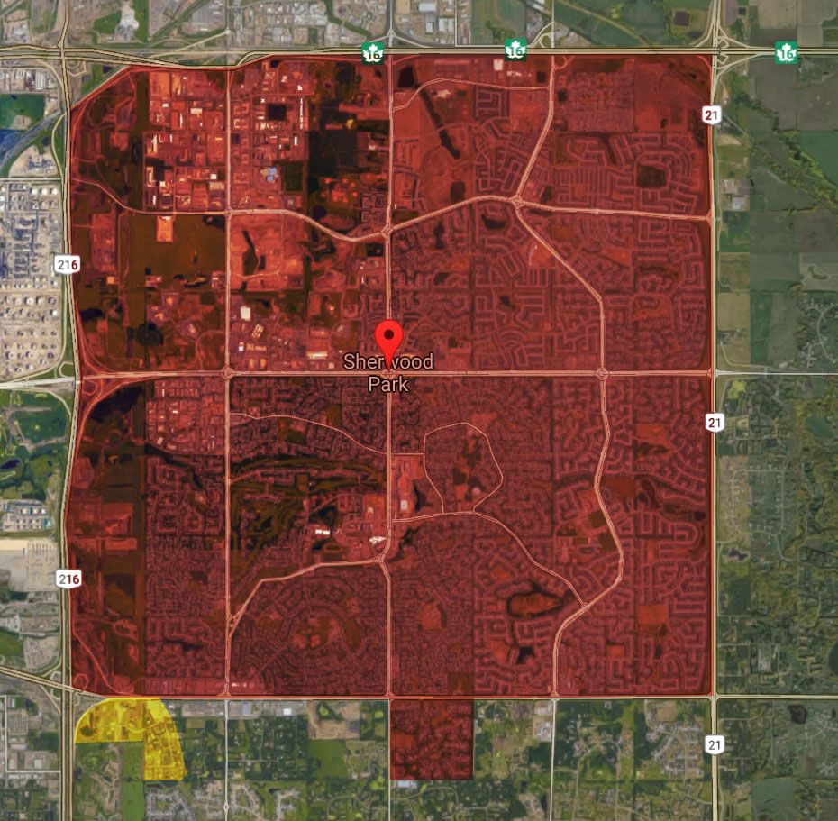
The boundaries of the Association shall be the boundaries of the Urban Service Area for the County of Strathcona as such is defined and amended from time to time by the Strathcona County Council, with the exception that the area of the Urban Service Area located north of Highway 16 shall not be included.
Description of Area
North Boundary:
Commencing at the Junction of Highway 16 and Highway 21 proceed west along Highway 16 to the City of Edmonton Corporate Limits.
East Boundary:
Commencing at the Junction of Highway 21 and Highway 16 proceed south along Highway 21 to the Junction of Secondary Highway 630 (known as Wye Road) and Highway 21.
South Boundary:
Commencing at the Junction of Secondary Highway 630 (known as Wye Road) and Highway 21 proceed west along Secondary Highway 630 to the Junction of Highway 14 and continue west along that portion of Highway 14 (known as the Sherwood Park Freeway to the City of Edmonton Corporate Limits plus the area south of Secondary Highway 630 located at the NW ¼ of Section 23, Township 52, Range 23 W4M that is known as the Estates of Sherwood Park. Residents of the area south of Secondary Highway 630 and east of Highway 14 located in the NW ¼ Section 21 Township 52, Range 23 W4M that is known as Hulbert Crescent/Ordze Park shall have the option of playing for either Sherwood Park or any other Member Association of Hockey Alberta within the County of Strathcona for which they qualify.
West Boundary:
Commencing at the point where Highway 14 (Sherwood Park Freeway) intersects the City of Edmonton Corporate Limits proceed north along the City of Edmonton Corporate Limits to a point where the City of Edmonton Corporate Limits intersect Highway 16.

